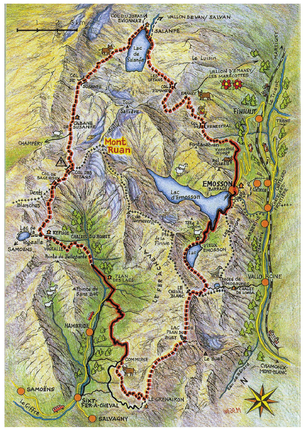
The Ruan Tour
Duration : 26 h
Length : 66 km
Period : June to October
Difficulty : T2 and T3
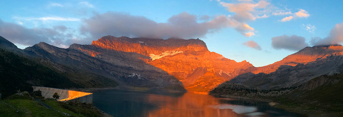
This fabulous trail runs along the border between Switzerland and France. It will take you to superb sites such as the Emosson and Vieux Emosson Dams, the Grenier de Commune, the Fer à Cheval (the Horseshoe), Vogealle, Susanfe, the Salanfe dam, Fenestral and the mountain pasture of Emaney. A route rich in fauna and flora, set in a landscape of imposing panoramas and intact wilderness.
Official website : www.tourduruan.com